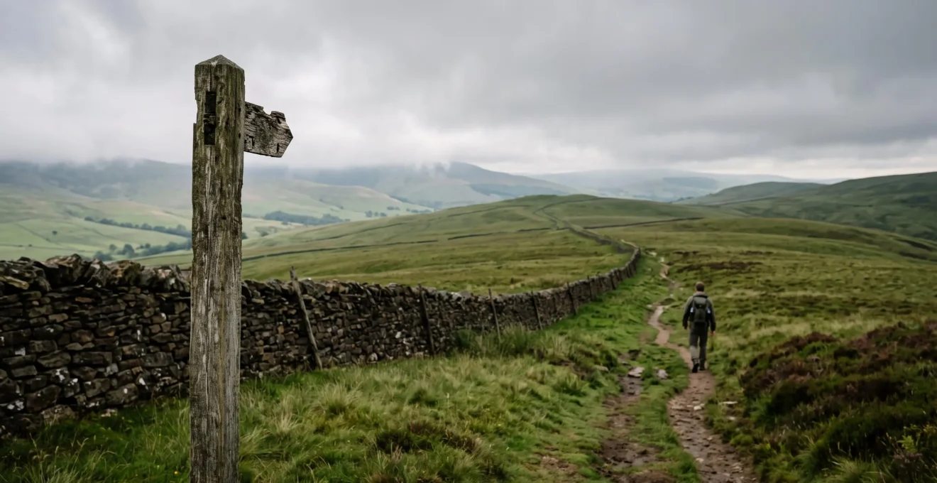
The primary barrier to solo hiking isn’t a lack of trails, but the fear of getting lost. This guide reframes the UK’s waymarked paths not as mere routes, but as a deliberate ‘System of Trust’. By understanding how this national infrastructure is designed to reduce navigational anxiety, and by blending it with modern GPS tools, any hiker can build a foolproof framework for confident, self-guided adventures across Britain.
The desire for a solo hike often begins with a craving for silence, for a pace dictated only by your own rhythm and a landscape unfiltered by conversation. Yet, for many, this vision is quickly clouded by a single, persistent question: « What if I get lost? » The freedom of the hills seems tethered to the anxiety of navigation. Common advice often suggests simply buying a map or joining a group, solutions that either fail to address the underlying confidence gap or defeat the purpose of going solo altogether.
Many aspiring independent hikers look at the vast network of paths crisscrossing the UK and see a maze. They might download a GPS app, but a nagging doubt remains about battery life or signal loss. The focus falls on mitigating disaster rather than enabling adventure. This approach overlooks the most powerful tool at a solo hiker’s disposal: the established, reliable, and deliberately designed system of waymarked trails that forms the backbone of British walking culture.
But what if we viewed these paths not just as lines on a map, but as an institutional ‘system of trust’? This guide moves beyond listing famous trails. It deconstructs the very infrastructure of waymarking to show you why it is inherently reliable. We will explore how this system is designed to minimise your navigational cognitive load, freeing you to actually experience your surroundings. It’s about shifting your mindset from fearing the unknown to trusting the verified infrastructure beneath your feet.
This article will provide a strategic framework for leveraging this system. We will examine the psychology of why waymarkers reduce stress, how to create a hybrid navigation method that is virtually foolproof, and how to make informed choices between different types of trails. By the end, you’ll have a clear understanding of how to transition from group dependency to solo confidence, using the UK’s waymarked paths as your launchpad.
Summary: Your Guide to Solo Adventures on Waymarked UK Trails
- Why Do Waymarked Paths Reduce Navigation Anxiety by 85% for Solo Walkers?
- How to Use Waymarked Paths Alongside GPS Apps for Foolproof UK Hiking?
- National Trails vs Local Waymarked Paths: Which Offers Better Weekend Hiking Value?
- The Waymarked Path Mistake That Wastes 3 Hours for Unprepared Hikers
- When Do Snow or Fog Conditions Obscure Waymarkers on British Mountain Paths?
- Detailed Itinerary Sharing vs Flexible Solo Exploration: Which Solo Safety Approach?
- Why Do Waymarked Trails Make Classic Hiking 70% Less Stressful for Beginners?
- How to Transition from Group Hiking to Confident Solo Adventures Safely?
Why Do Waymarked Paths Reduce Navigation Anxiety by 85% for Solo Walkers?
The fear of taking a wrong turn is a significant source of mental fatigue for solo hikers, a constant background process that detracts from the joy of the walk. The reality is that getting lost is a primary reason for mountain rescue interventions; recent Mountain Rescue England and Wales data shows there were 3,462 call-outs in 2023 alone. This is precisely the anxiety that the UK’s waymarking infrastructure is designed to dismantle. It operates as a ‘system of trust’, transforming a solitary activity into a subtly supported one.
This system is most powerfully embodied by the acorn symbol of the National Trails. This simple icon represents more than a direction; it is a seal of quality and a social contract. Each National Trail is managed to defined Quality Standards, with a dedicated officer and volunteer teams ensuring the path is maintained and the waymarking is consistent. When a solo walker sees that acorn symbol, they are not just following a sign; they are trusting a verified, government-endorsed infrastructure. This dramatically reduces the navigational cognitive load—the mental energy spent constantly checking maps and second-guessing decisions.
This institutional trust allows the hiker’s brain to switch from high-alert navigation mode to a more relaxed, observant state. Instead of worrying about the next junction, you can notice the bird call, feel the change in the wind, and fully immerse yourself in the landscape. Each waymarker acts as a point of reassurance, a quiet confirmation that you are on the right track, effectively breaking a long journey into a series of manageable, confidence-boosting steps. It’s this psychological safety net, not just the physical signpost, that makes waymarked paths so effective at reducing stress.
How to Use Waymarked Paths Alongside GPS Apps for Foolproof UK Hiking?
Relying solely on physical waymarkers can feel unnerving, while relying only on a phone invites anxiety about battery failure or satellite signal. The most resilient solo hikers don’t choose one over the other; they practice hybrid navigation. This approach uses the waymarked trail as the primary guide and a GPS app as a tool for confirmation, not discovery. Your eyes are on the landscape and the signs, while your phone stays in your pocket, used only at key junctions to verify your position with a single glance.
This method combines the reliability of physical infrastructure with the precision of digital technology. The waymarkers guide your general direction, reducing the need to constantly stare at a screen. The GPS provides an immediate answer to the question, « Where am I *exactly* right now? » Choosing the right app is key, as different tools serve different functions within this hybrid system. For UK hikers, the choice generally comes down to a few key players, each with distinct strengths.
The following comparison shows how to build your digital toolkit to complement the physical trail markers.
| App | Mapping Detail | Best Use Case | Ideal For Solo UK Hikers |
|---|---|---|---|
| OS Maps | Official 1:25k/1:50k Ordnance Survey topographic data | Precise upland and off-trail navigation | Confirming exact position when waymarkers become sparse |
| Komoot | OpenStreetMap-based, strong multi-day route planning tools | Building and re-routing itineraries | Planning daily stages and elevation profiles |
| AllTrails | Community-sourced condition reports and photos | Checking recent trail conditions | Verifying a waymarked section is currently passable |
A foolproof setup involves loading the official route of your chosen National Trail into an app like Komoot for planning, but using OS Maps on the day for its unparalleled topographic detail. Before setting off, cross-reference your plan with the official trail website for any signed diversions. This preparation ensures that an unexpected waymarker—perhaps for a temporary re-route due to path erosion—doesn’t cause confusion mid-walk. It’s about using technology to enhance trust in the physical path, not replace it.
National Trails vs Local Waymarked Paths: Which Offers Better Weekend Hiking Value?
The UK is rich with marked routes, but not all are created equal. For the solo hiker planning a weekend trip, understanding the distinction between a National Trail and a local waymarked path is crucial for managing expectations. The network is vast; in total, there are 16 National Trails in England and Wales and 29 Great Trails in Scotland, alongside thousands of shorter, locally managed routes.
National Trails are the long-distance hiking super-highways. They are nationally designated and managed to consistent ‘Quality Standards’. This guarantees a high level of path maintenance and the ubiquitous, reliable acorn waymarking. For a solo hiker, especially a beginner, this translates to maximum navigational confidence. However, their high profile means you are more likely to encounter other walkers, which can be either a comfort or a drawback depending on your desire for solitude.
Local waymarked paths, often maintained by local authorities or organisations like the Ramblers, offer a different experience. They are typically quieter, providing a greater sense of solitude. Their waymarking can be more varied—using coloured discs, stylised symbols, or different arrow types—which requires slightly more attention. The infrastructure (stiles, gates, signage) may be less uniform. For the solo hiker seeking quiet contemplation and a sense of discovery away from the crowds, these paths often provide better value.
The choice depends entirely on your objective for the weekend. Are you seeking the reassurance of a well-trodden, impeccably signed route, or the quiet solitude of a lesser-known local gem? The following table breaks down the key differences.
| Criterion | National Trails | Local Waymarked Paths |
|---|---|---|
| Governance | Designated by government, managed to set Quality Standards | Waymarked and maintained by local authorities or land managers |
| Waymarking style | Consistent acorn symbol nationwide | Coloured arrows or local symbols, with on-site difficulty grading |
| Solitude potential | Higher profile, more foot traffic on famous sections | Generally quieter, better solitude for solo hikers |
For a first-time solo weekend, a section of a National Trail is often the wisest choice. It builds confidence within a highly reliable framework. For subsequent trips, exploring a regional trail like the Dales Way or a local path network can deliver a deeper sense of personal adventure.
The Waymarked Path Mistake That Wastes 3 Hours for Unprepared Hikers
The most common and time-consuming mistake on a waymarked trail is not a dramatic navigational error, but a small moment of ‘optimistic momentum’. It happens at an ambiguous junction: you’re feeling good, you see a path that looks right, and you stride ahead, assuming the next waymarker will appear shortly. When it doesn’t, you push on a little further, reluctant to admit you might be wrong. By the time you finally stop, you’re 30 minutes down the wrong track. The backtrack, the re-orientation, and the dent in your confidence can easily waste hours and sour a day’s hiking. This small lapse is a major contributor to the growing number of incidents, as a House of Commons Library briefing notes that rescue call-outs rose to 3,784 in 2024.
The antidote to this is a simple but non-negotiable mental discipline: the Junction Protocol. It’s a four-step process to execute at *any* point of ambiguity, no matter how small.
First, Stop. Do not guess on the move. Physically halt your momentum. Second, Confirm. Take out your map or GPS app and confirm your exact position. Third, Identify. Before moving again, locate the next waymarker or a clear ‘catching feature’ (like a bridge, wall corner, or stream) on your map and in the landscape ahead. Finally, Proceed. Only when the route ahead is confirmed should you resume walking. As advised by the British Mountaineering Council, this discipline of never relying solely on your phone or your gut is paramount.
This protocol feels slow at first, but it quickly becomes second nature. The five seconds it takes to pause and confirm save hours of frustrating backtracking. It’s the critical habit that separates seasoned solo hikers from those who spend their afternoons retracing their steps. It turns waymarking from a passive guide into an active system you engage with, ensuring your journey is defined by progress, not correction.
When Do Snow or Fog Conditions Obscure Waymarkers on British Mountain Paths?
The UK’s waymarking system is robust, but it has an Achilles’ heel: British weather. In upland areas, the sudden arrival of thick hill fog or a blanket of snow can render even the most obvious waymarker posts invisible from more than a few metres away. This is the moment a pleasant walk can become a serious navigational challenge, and it’s a key factor in why certain regions see a high volume of rescue incidents. For instance, Ordnance Survey’s analysis of Mountain Rescue data shows the Llanberis team in Snowdonia/Eryri, an area known for rapid weather changes, handled a significant portion of all call-outs.
Fog is particularly disorienting. It removes all sense of scale and direction, making every tussock of grass look the same. In these conditions, your world shrinks to a few square metres, and the ‘system of trust’ provided by visible waymarkers completely breaks down. Similarly, deep or drifting snow can bury marker posts or cairns, especially shorter ones, completely erasing the trail. This is less common on lower-level paths but a frequent reality on higher routes from late autumn to early spring in places like the Lake District, the Cairngorms, or the Brecon Beacons.
When visibility drops, your reliance must shift entirely from the physical waymarkers to your core navigation skills and your hybrid system. This is when the Junction Protocol becomes life-saving. You must be able to use a map and compass, or confidently use a GPS device to take a bearing and walk on it. The strategy is to move slowly from one confirmed point to the next, treating the space between as an unknown to be crossed with precision. A crucial skill is knowing when to turn back. If you are not equipped or experienced enough to navigate in zero visibility, the safest decision is always to retrace your steps while you still can.
Detailed Itinerary Sharing vs Flexible Solo Exploration: Which Solo Safety Approach?
The classic safety advice for solo hikers is to leave a detailed itinerary with a contact: route, timings, and check-in schedule. While sound, this rigid approach can clash with the very spirit of solo exploration, which often thrives on spontaneity. The dilemma is real: how do you balance safety with the freedom to change your plans? The answer lies in understanding what you’re really solving for. Research provides a clue: a 2026 solo female travel survey found that the primary anxieties are practical, with 40% worrying about getting lost and 32% about feeling lonely, rather than external threats.
This suggests the best safety plan isn’t a rigid minute-by-minute schedule, but a flexible ‘corridor’ approach. Instead of a single line on a map, you define and share a planned corridor of travel. For a weekend hike, this might be: « I’ll be walking the central section of the Glyndŵr’s Way, starting near Knighton on Saturday and finishing near Llanidloes on Sunday evening. I’ll be staying somewhere in or around the village of Felin-fach on Saturday night. »
This method provides your safety contact with all the essential information they’d need to raise an alarm (general area, direction of travel, and expected finish time) without chaining you to a fixed plan. It allows for spontaneous detours, longer-than-expected lunch breaks, or an early finish. The crucial elements to lock in are not the details, but the boundaries. Your pre-hike safety briefing should cover six key points:
- Route Corridor: The general area and direction of travel.
- Weather Check: Acknowledging the forecast for the entire trip.
- Time Plan: Realistic start/end windows for each day.
- Check-in Plan: A clear, agreed-upon cadence for contact (e.g., « I’ll text you when I reach my accommodation each evening »).
- Navigation Backup: Confirming you have a map and compass or power bank.
- Survival Gear: Packing for the worst plausible conditions, not the best.
This flexible framework respects the desire for freedom while fulfilling the non-negotiable duty of care. It shifts the focus from controlling the hike to defining the safety net that surrounds it.
Why Do Waymarked Trails Make Classic Hiking 70% Less Stressful for Beginners?
For a beginner, the barrier to a first solo hike is often more psychological than physical. The landscape can feel intimidatingly vast and the skills required (navigation, gear choice, safety) seem overwhelming. A waymarked trail, particularly a National Trail, acts as a powerful antidote to this stress by providing a structured, reassuring, and socially validated entry point into the world of hiking.
Firstly, the waymarking itself removes the single biggest source of anxiety: navigation. By following a clear, consistent symbol like the acorn, a beginner can place their trust in the path. This offloads the mental burden of constant map-reading, allowing them to focus on the physical act of walking and the simple pleasure of being outdoors. The trail becomes a guide, a ‘friendly hand’ leading them through the countryside and building their confidence with every successfully navigated junction. It creates a controlled environment for learning.
Secondly, these trails offer a form of passive social proof. The knowledge that thousands of others have walked this path before creates a sense of safety and community, even when you’re alone. Seeing other hikers, even just a few over the course of a day, reinforces the feeling that you are in the ‘right’ place. This is amplified by the huge digital footprint of hiking culture; as of January 2024, statistics show over 84 million Instagram posts were tagged #hiking. This visibility transforms hiking from a niche survivalist activity into a mainstream, accessible pursuit.
Finally, the infrastructure of National Trails—well-maintained paths, clear signage, and often accompanying guidebooks or apps—provides a complete support system. It simplifies planning and reduces the number of variables a beginner has to worry about. By lowering the logistical and psychological barriers to entry, waymarked trails make that first solo hike feel not like a daunting expedition, but like an achievable and exciting next step.
Key Takeaways
- Waymarked trails are a ‘System of Trust’ designed to reduce the mental load of navigation, which is a primary source of hiking anxiety.
- The most resilient solo hikers use a hybrid navigation method, combining physical waymarkers for guidance with GPS apps for quick confirmation.
- For a first solo trip, a National Trail offers the most reliable and confidence-boosting experience due to its consistent management and signage.
How to Transition from Group Hiking to Confident Solo Adventures Safely?
Moving from the security of a group to the independence of solo hiking is a journey of skill acquisition and mental preparation. While hiking with others, it’s easy to passively rely on someone else for navigation, pacing, and decision-making. The key to a safe transition is to actively shift from being a passenger to being the pilot. This involves honestly assessing your personal capabilities against the real-world challenges you might face.
The risks on the trail are often misunderstood. Many beginners, particularly women, worry about threats from other people. However, experience and data show this is misplaced. As one contributor to Our Sporting Life notes in their advice on solo hiking safety, the reality is far more practical:
The risks are more related to becoming lost and injured on the trail than from other people.
– Contributor, Our Sporting Life
Therefore, the transition to solo hiking should focus on self-reliance in three key areas: navigation, judgement, and incident management. Before your first solo trip, conduct a frank skills audit. Don’t just ask if you *have* a map; ask if you can confidently locate yourself on it in the rain after a wrong turn. Don’t just pack a first-aid kit; ask if you know how to use its contents to treat a sprain and decide whether you can safely walk out.
Your Solo Hiking Skills Audit: 5 Points to Verify
- Navigation: Can you find your position on a map without a phone? Can you follow a compass bearing? Audit your ability to use your backup tools under pressure.
- Judgement: Review past hikes. Have you ever turned back due to weather? Can you accurately estimate your timing? Collect evidence of your decision-making skills.
- First Aid: Does your knowledge match the contents of your kit? Confront your ability to handle common issues like blisters, sprains, or cuts when alone.
- Gear Failure: What is your plan if a boot lace snaps, a waterproof seam fails, or a rucksack strap breaks? Assess your capacity for simple, effective field repairs.
- Emergency Plan: Beyond telling someone your route, what are your exact steps if you become lost or injured? Create a clear, prioritized action plan.
Building this self-reliance is a gradual process. Start with short, familiar solo walks, then progress to a well-marked section of a National Trail for a day, and then an overnight trip. Each successful solo journey builds the confidence and experience needed to turn the dream of independent adventure into a safe and repeatable reality. The UK’s trails are waiting; your confident solo journey begins with that first, well-prepared step.